Sharp ridges, vertical drops, Alpine ibex, and the stairs of Cirith Ungol. Let me introduce you to one of the most spectacular hikes in the world. No, it’s not hyperbole.
For a number of years now, “visiting my family” has meant going to Switzerland rather than Norway. If you follow my instagram, you will know that my family and I are avid backcountry enthusiasts and that we spend the majority of the winter season climbing peaks in search of untouched powder. This summer, however, I got to explore the Swiss Alps with my trail shoes on.
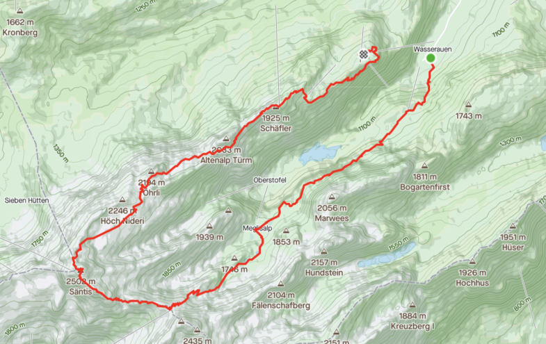
On a warm summer day in early August, we packed a small day pack, put on some extra sunscreen, and set off for the Swiss region of Appenzell. Having spent the previous two days researching hikes in the area, we had landed on a 20-kilometer trek that would take us from our starting point at Wasserauen, via a lake, a village, and a mountain pass, to Säntis (2,501 MOH), and then back to Wasserauen via a spectacular ridgeline.
Hiking, like off-piste skiing, is a social distancing-approved sport and thus perfect for the summer of 2020. With the exception of the starting point, a field turned into a parking lot that already had hundreds of cars parked when we arrived around 9 am, we were mostly alone.
Here are some highlights from our trek:
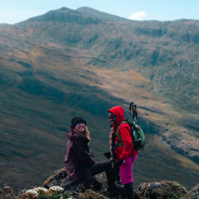
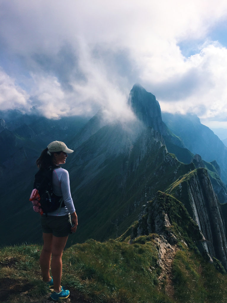
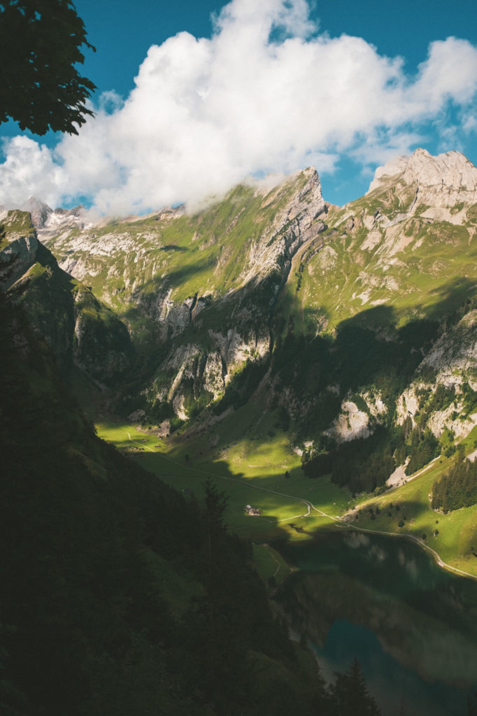
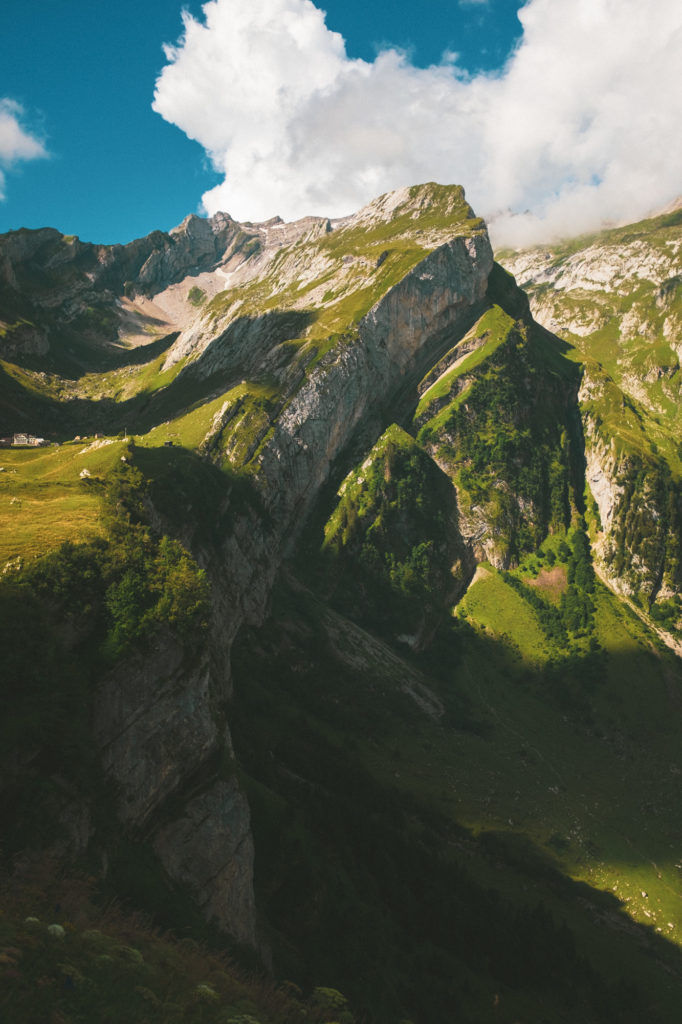
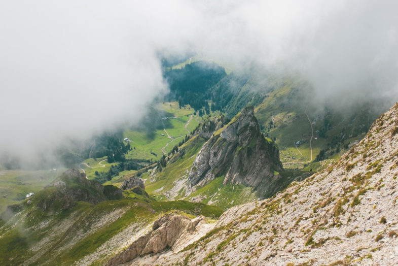
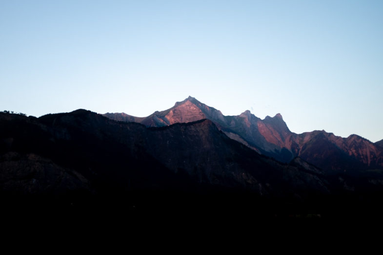
The combination of harsh sunlight, clouds, and shade from the mountains made capturing the scenery an interesting challenge that I’m not sure I succeeded at.
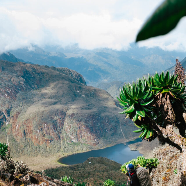
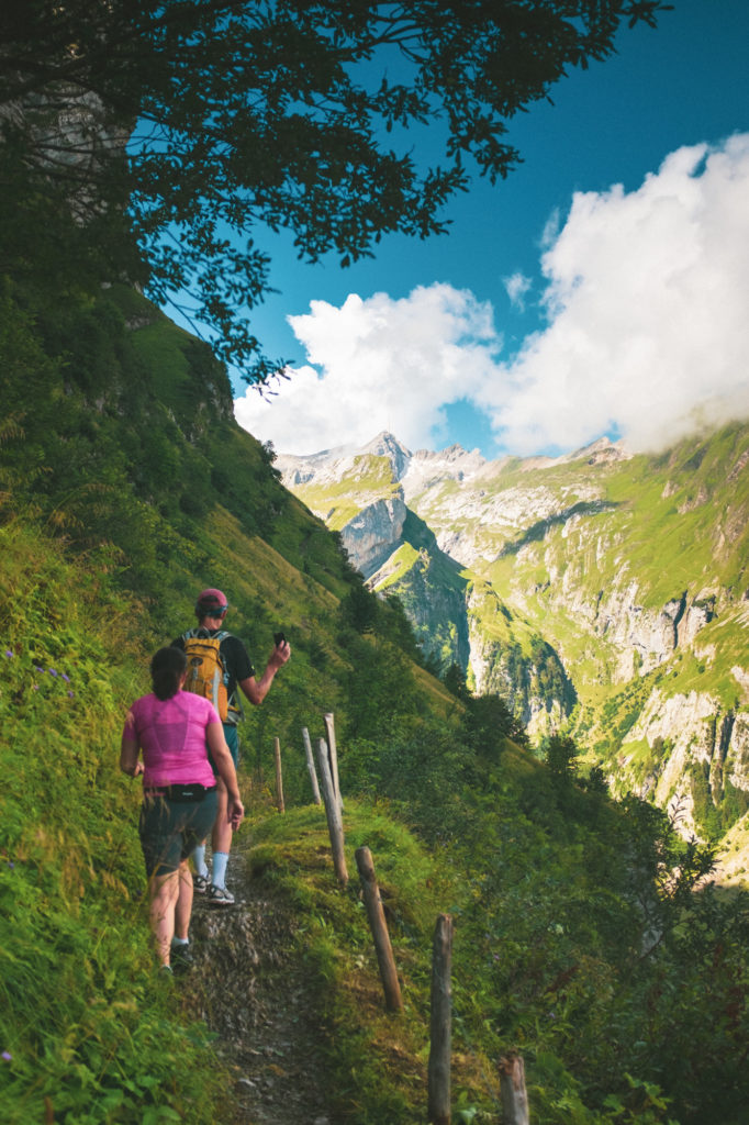
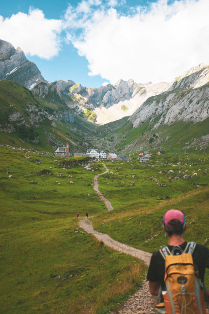
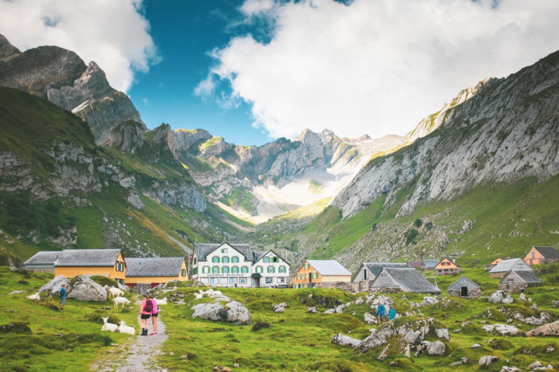
After climbing countless meters and passing the Seealpsee (the lake in the bottom right corner ^), we rounded a corner and spotted a tiny village nestled on a ledge surrounded by mountains. I’ve rarely seen nature show off more and these photos do not do it justice:
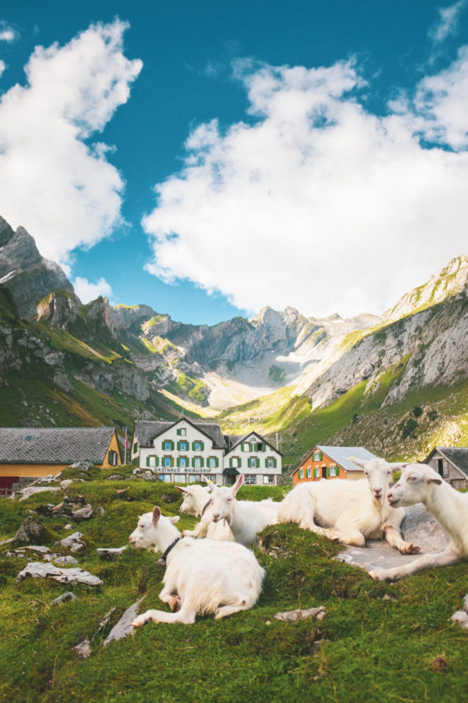
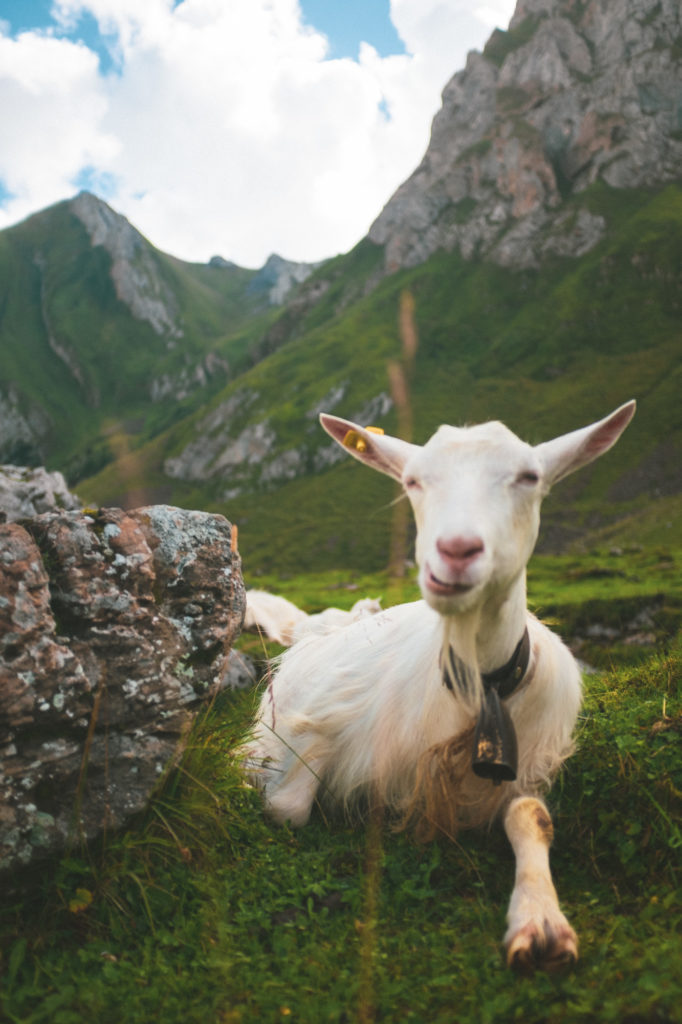
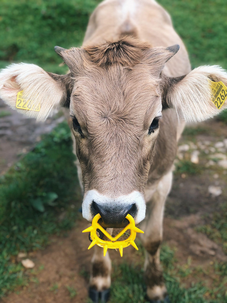
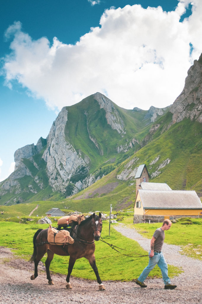
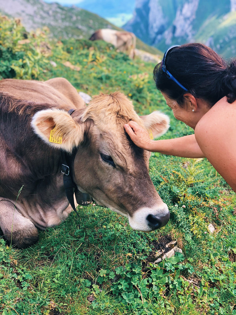
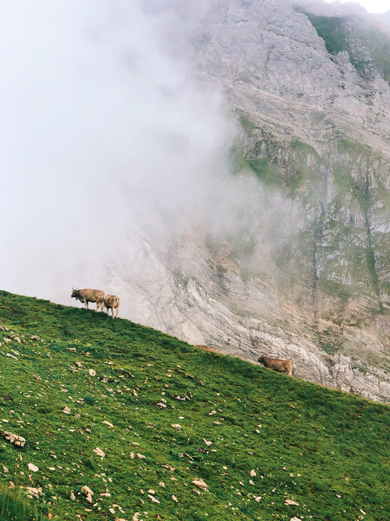
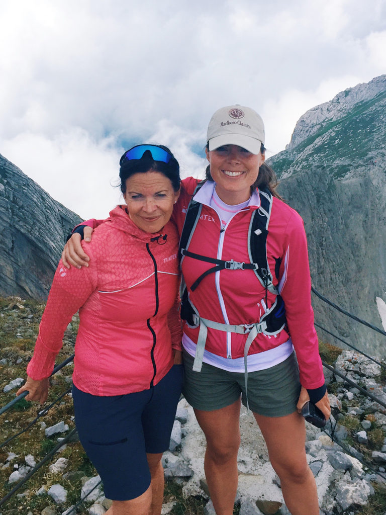
As long time followers of this blog will know, my favorite animals are (mountain) goats and cows. I was not disappointed on this trip. We also met a horse:
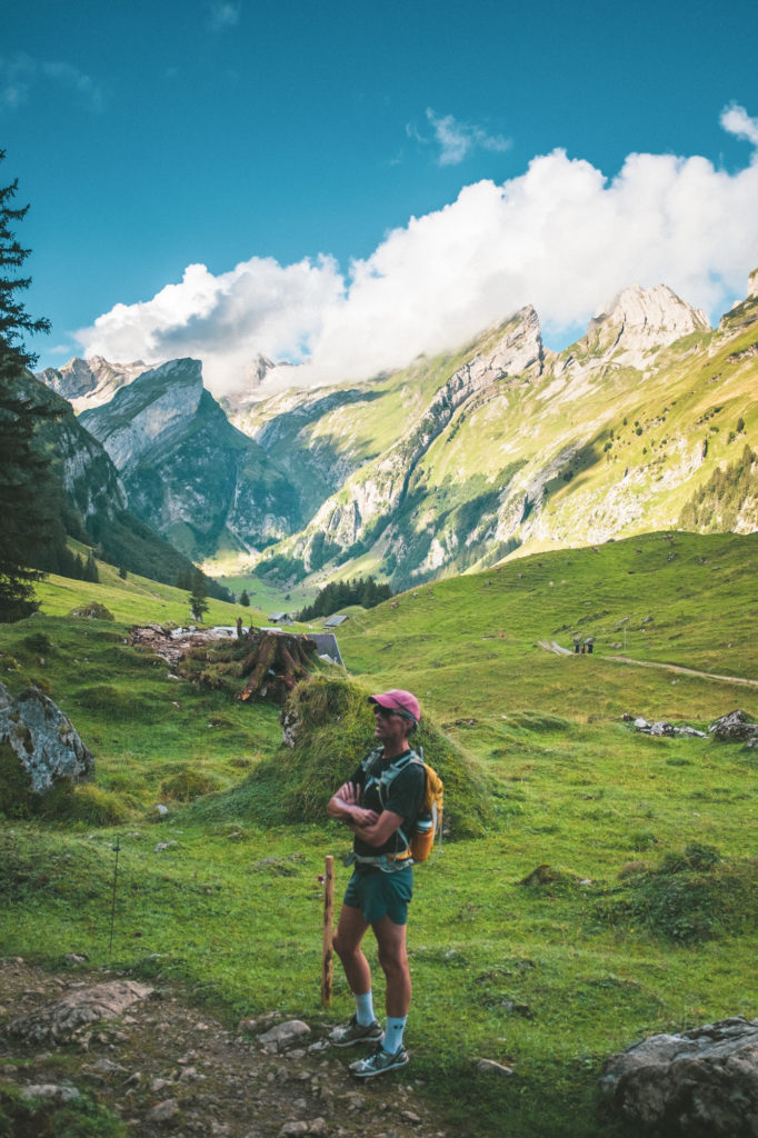
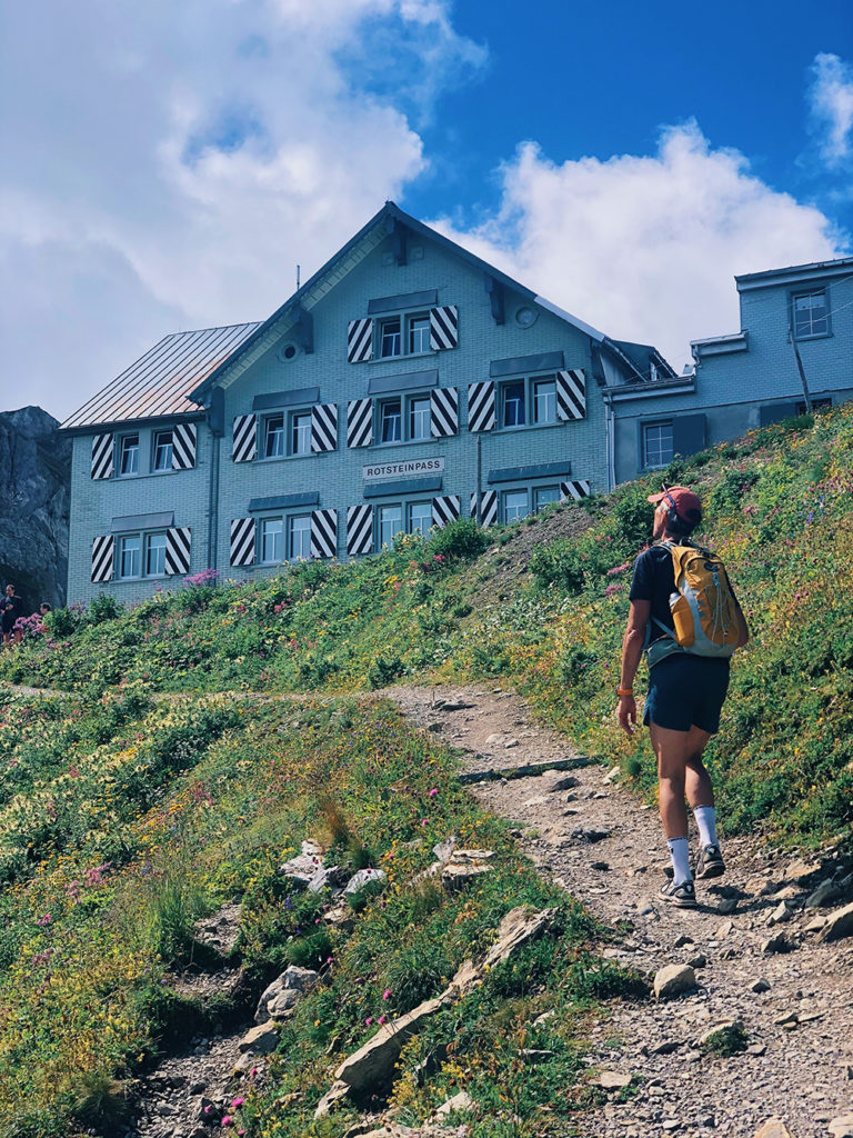
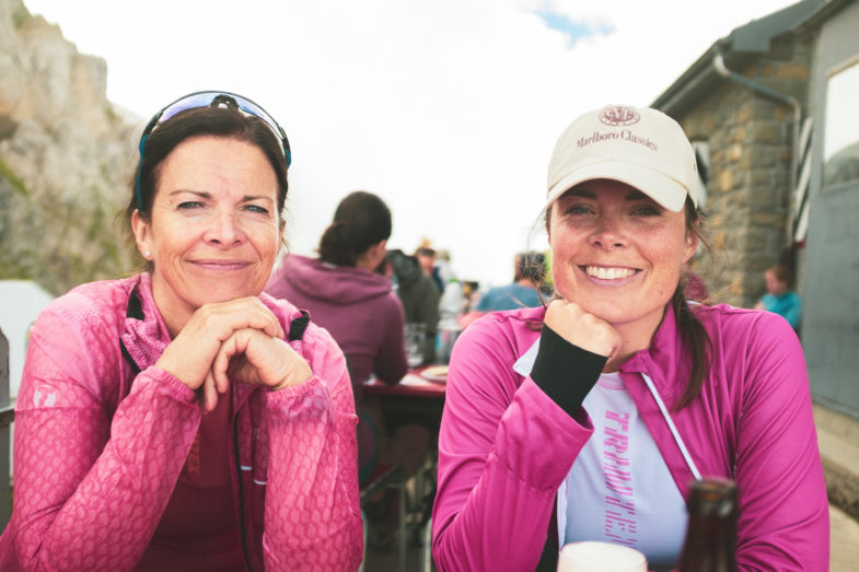
From the village, called Meglisalp, we started on the ascent to our first stop: Rotsteinpass. After a strenuous climb up well-maintained but steep trails, we collapsed at the first table we could find on the terrasse at the Berggasthaus and ordered a well-deserved, ice-cold beer.
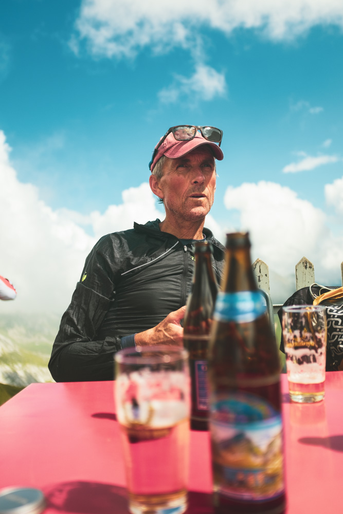
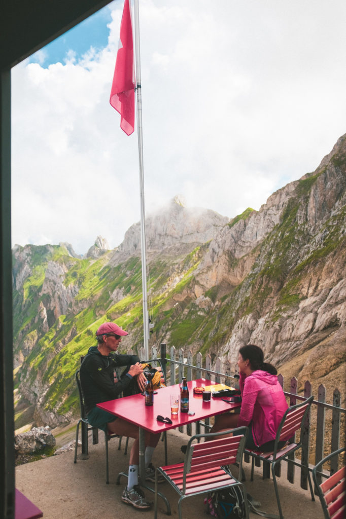
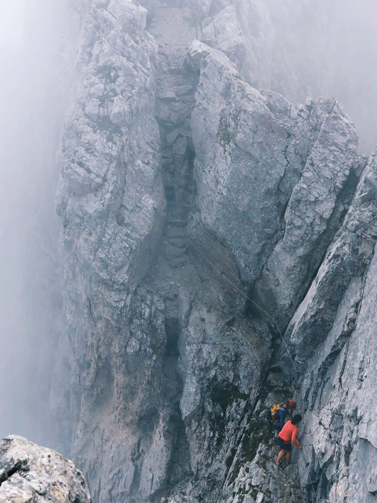
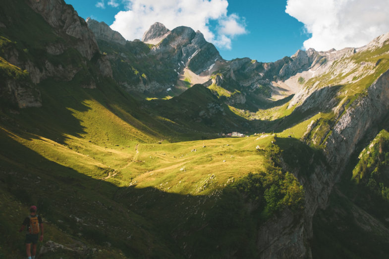
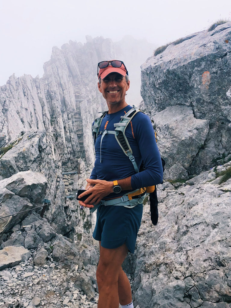
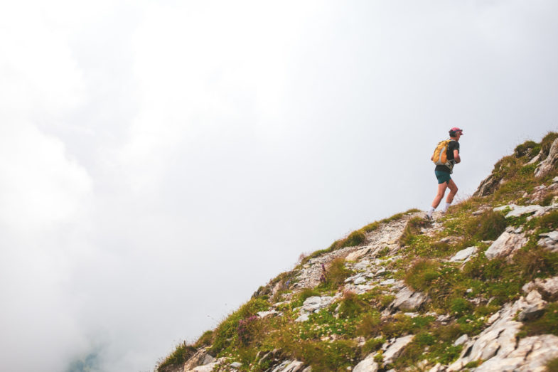
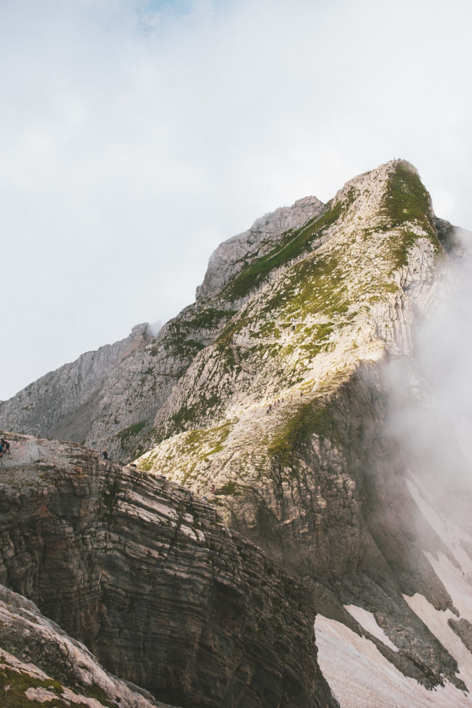
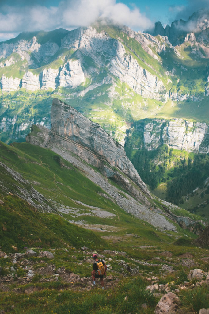
After a short break, we paid for our drinks (with the little cash we had, as they did not take cards at this mountain hut), and started climbing the ridge following the signs towards Säntis. Little did we know that the spectacular exploration had just begun!
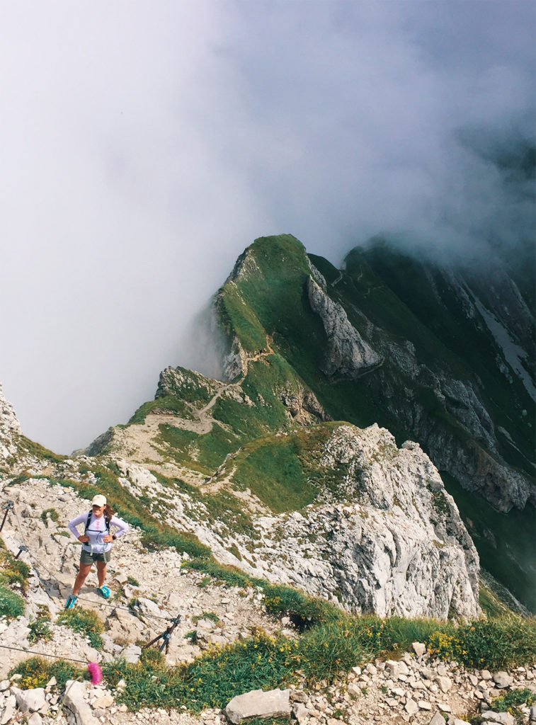
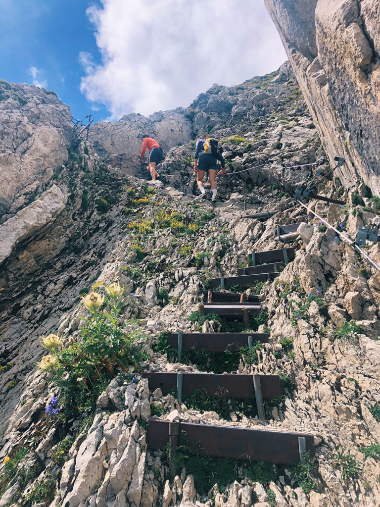
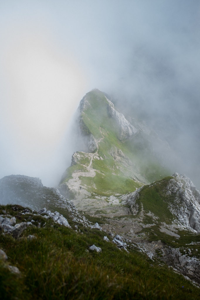
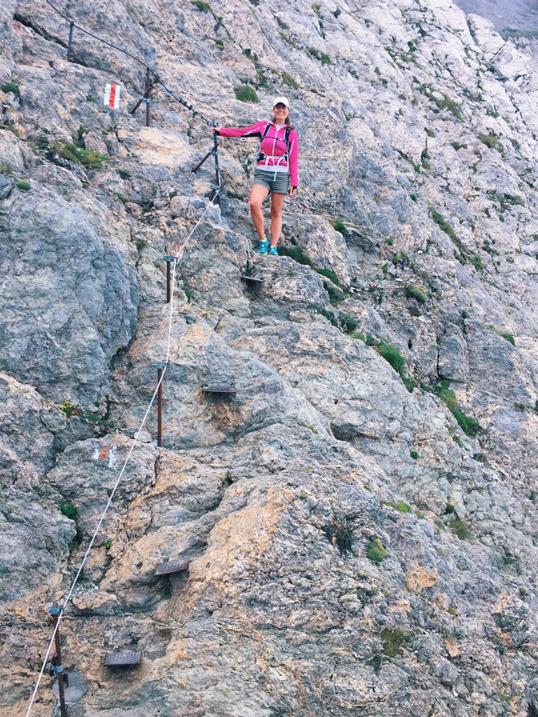
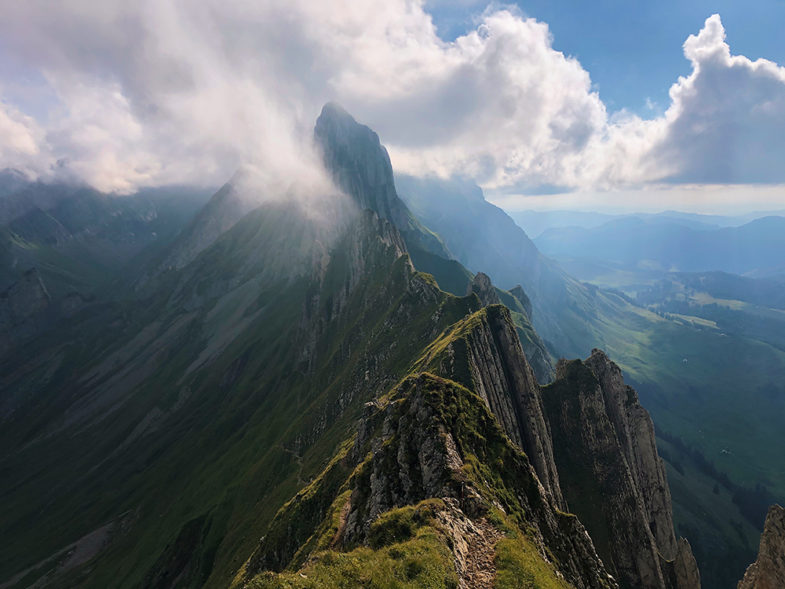
After climbing an increasingly steep and treacherous incline, we suddenly entered the borderlands of Mordor. The stairs of Cirith Ungol are pretty sketchy, even without Shelob lurking in the shadows. Much like Smeagol, I was giddy with excitement.
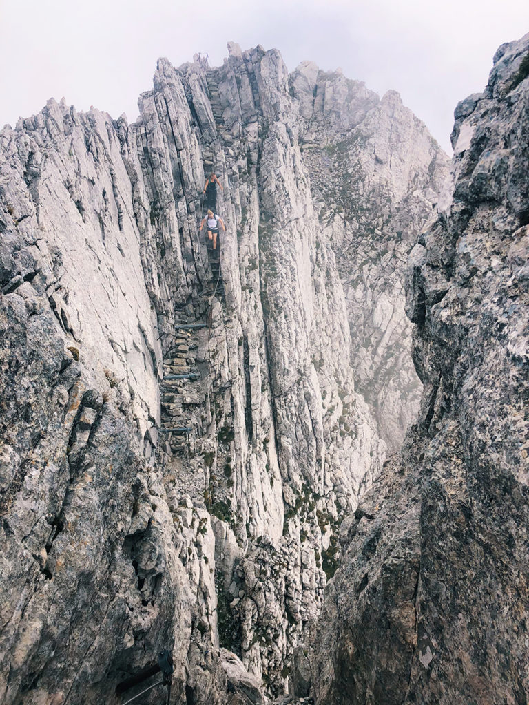
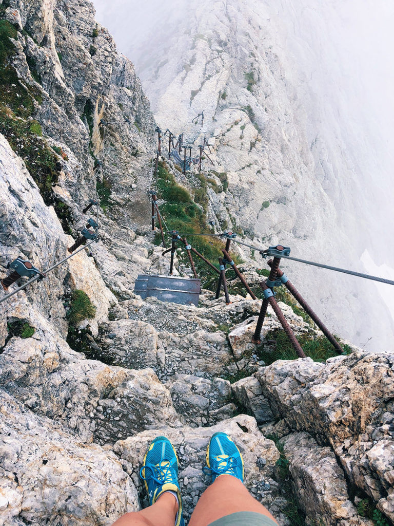
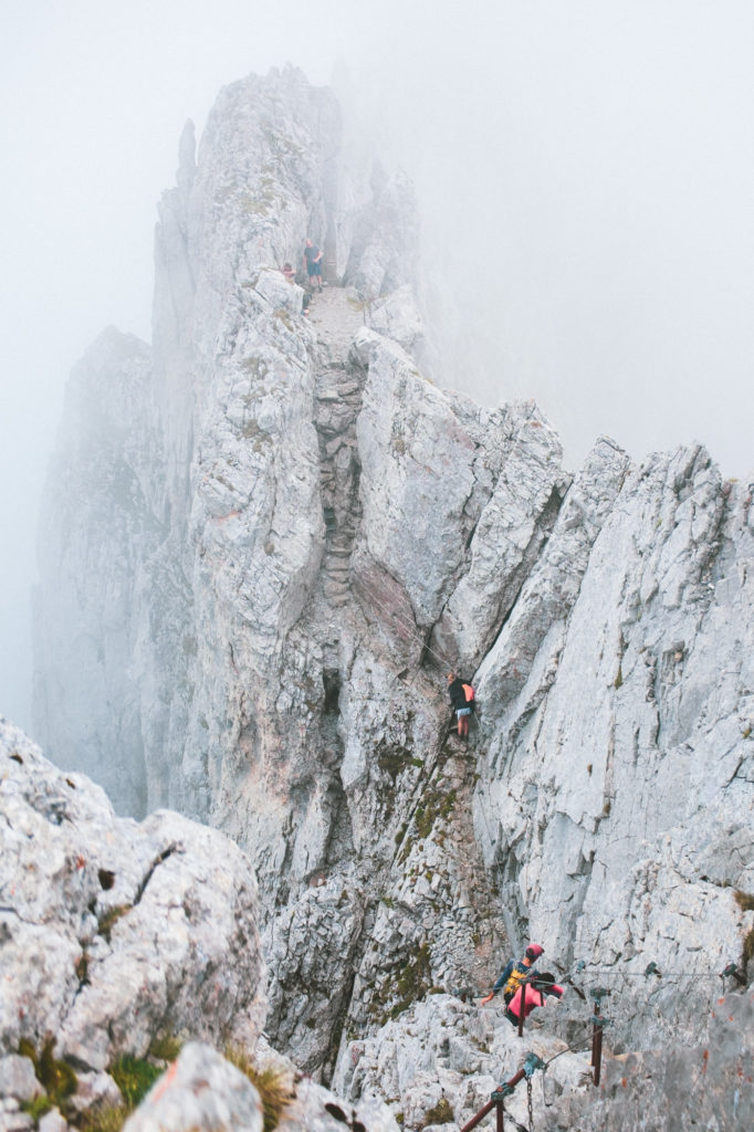
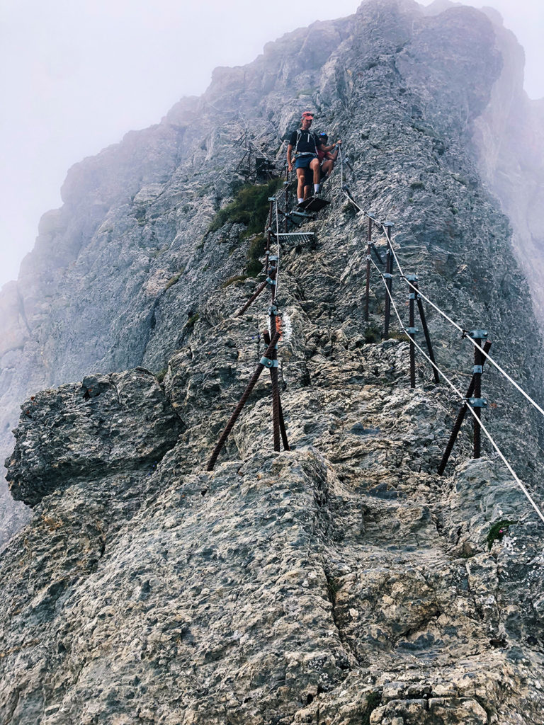
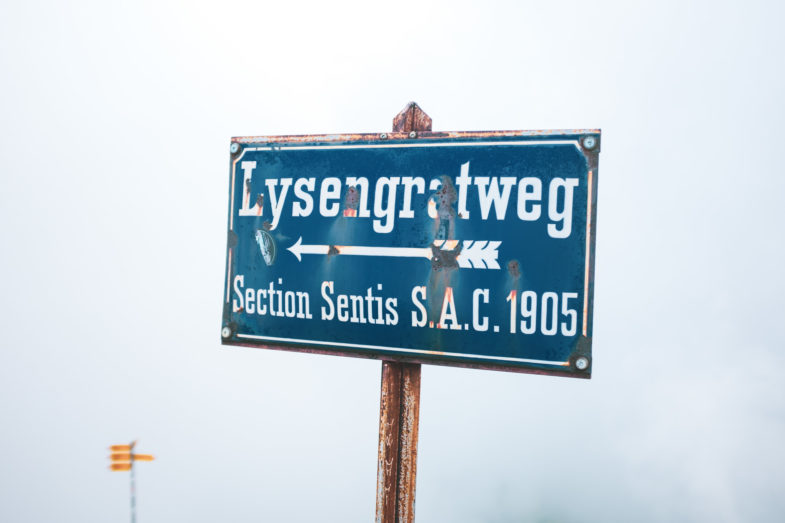
The stairs ended much too soon (or not soon enough if you ask my mother) and gave way to a much flatter trail along the ridge. With stomachs that were growling for sustenance, we left the stairs of Cirith Ungol behind. Or Lysengratweg as it is apparently also called.
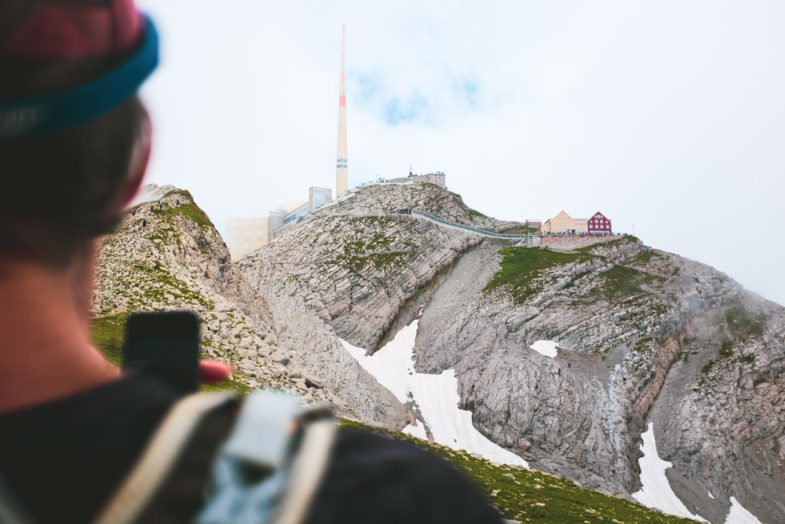
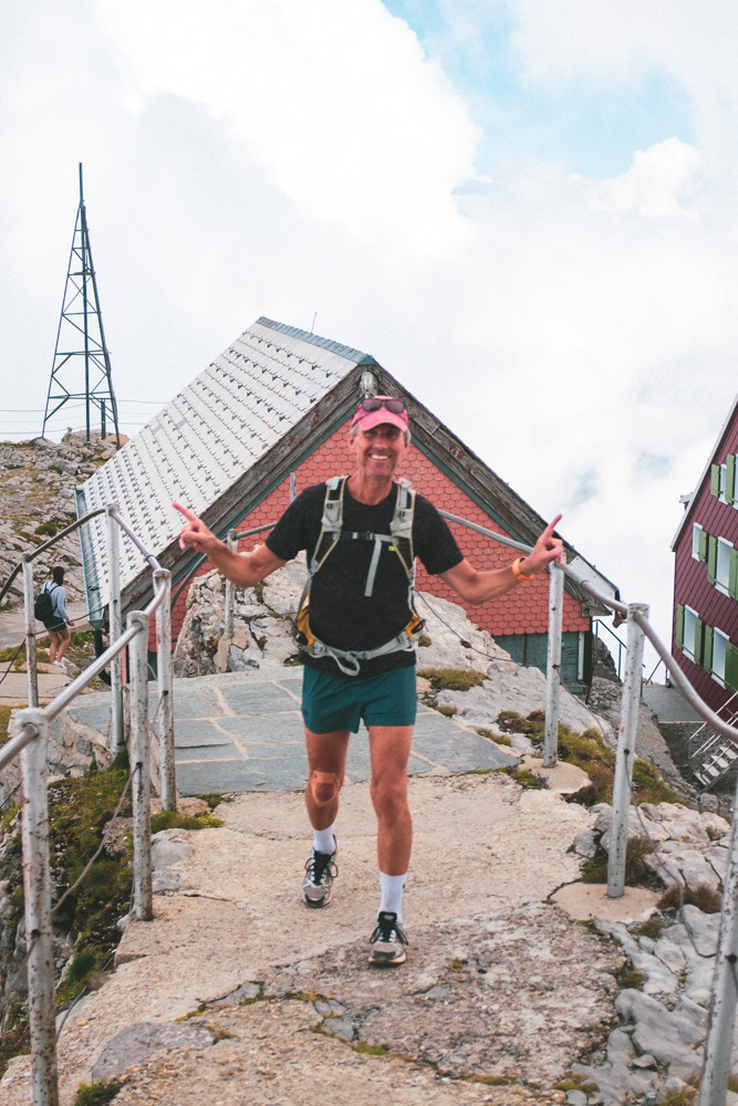
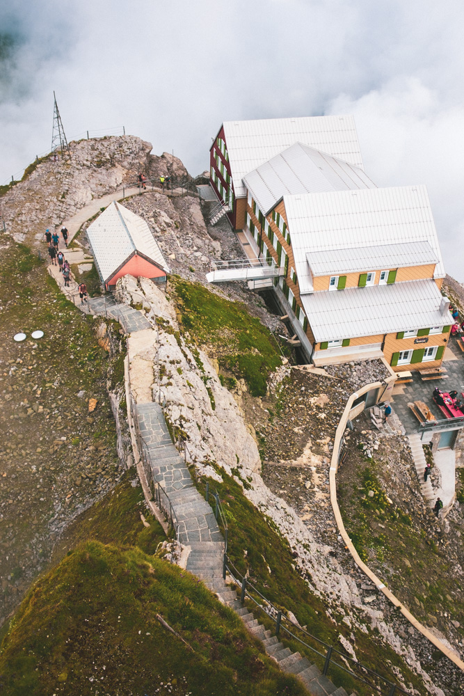
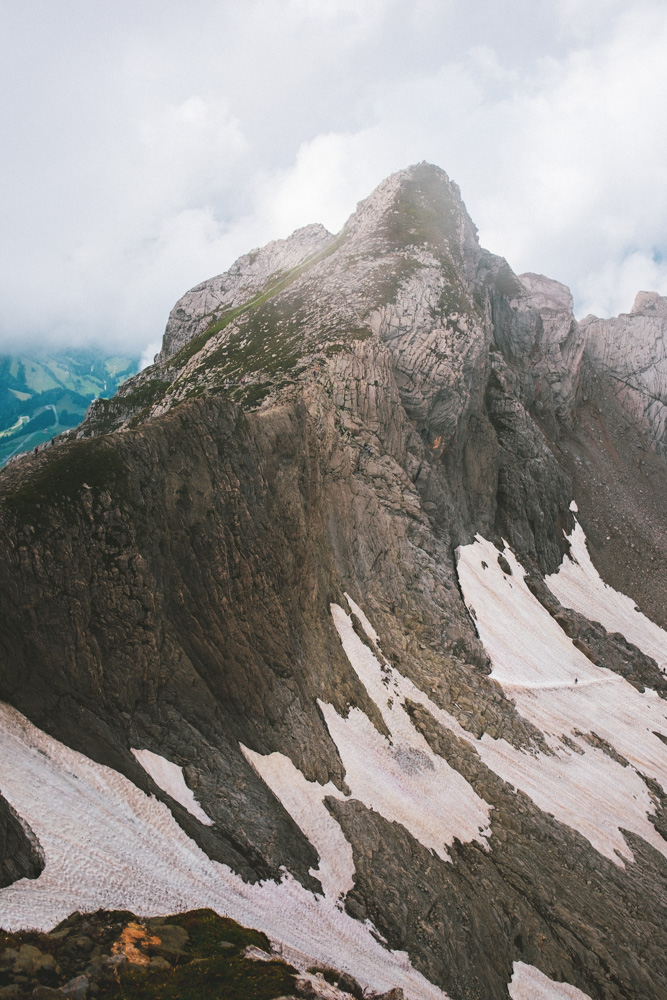
And then we were suddenly there: Our halfway point and lunch spot. Säntis. 2,501 meters above sea level, the majority of which we had traversed that morning. On sunny days, six countries can be seen from the top of Säntis: Switzerland, Germany, Austria, Liechtenstein, France, and Italy. We barely saw Switzerland through the clouds that clung to the peak.
Luckily, their restaurant served sausages and Möhl cider, so we were happy with the destination either way.

After lunch, my mum opted out of more ridge lines adventures and took the gondola down to the flatlands, while my dad and I continued our trail running back towards Wasserauen.
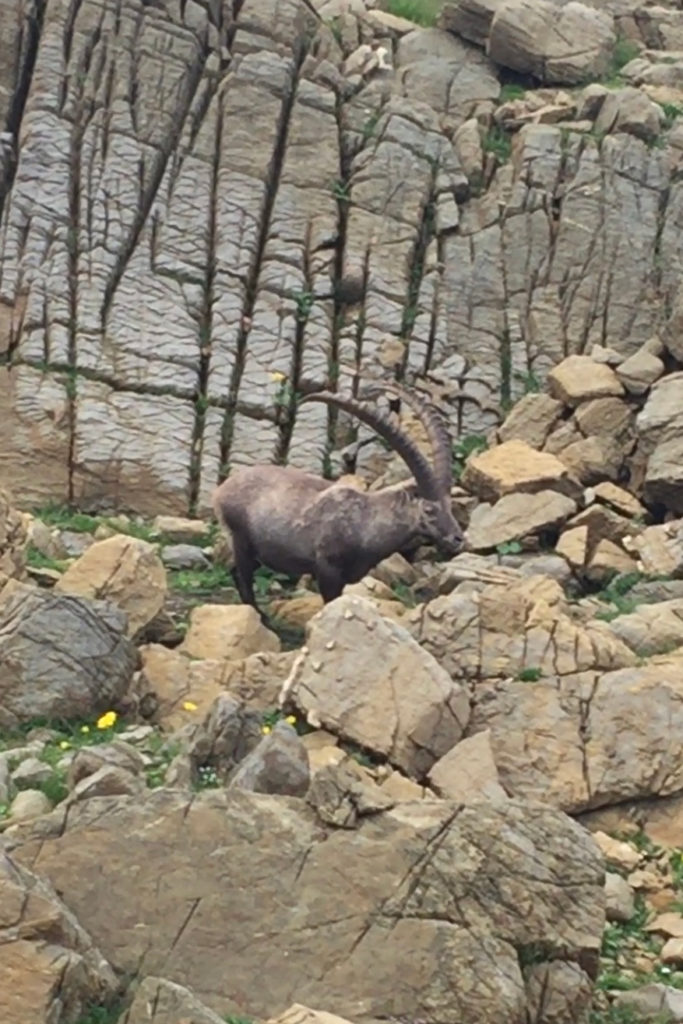
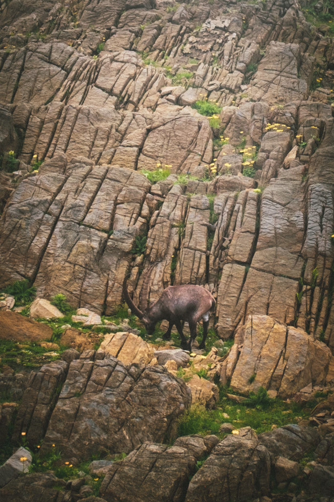
Steinbukk! 😍 Or Alpine ibex as they’re also called:
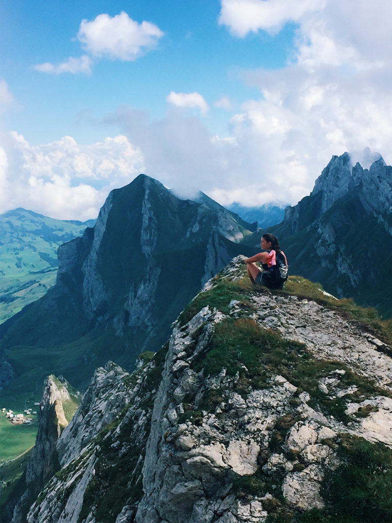
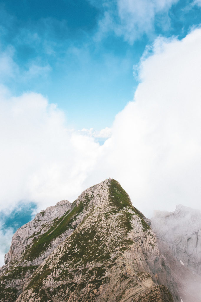
Honestly, there was so much scenery to capture that I gave up in the end. This trail requires multiple return trips. I mean, look at this:
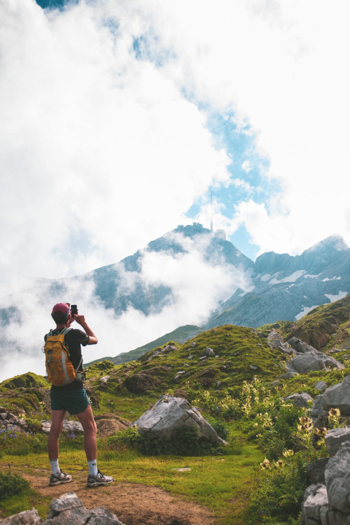
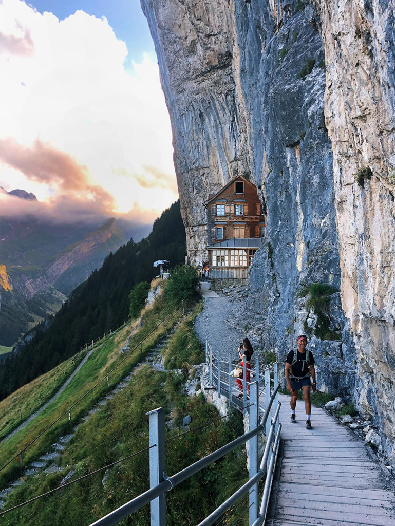
When we thought we had seen it all we managed to squeeze in two-second-look, while running to catch the ski lift, at the instagram-famous Berggasthaus Aescher:
… and then it was suddenly over. We caught the last ski lift down from Ebenalp and grabbed a cold beer at the hiker’s bar before heading back home. Hike well done!
The scorecard: 22.49 km, 2094 meter elevation gain, 4 Alpine ibex, and the stairs of Cirith Ungol. 10/10 would recommend.